


Explore the famous Arnside Knott on this circular walk through Silverdale, created in collaboration with Walks Around Britain, and enjoy the stunning scenery of the South Lake District from the Arnside Knott viewpoint. Plus, you’ll also enjoy walks along the beach and Arnside’s fabulous wildlife!
Arnside Knott Walk & Viewpoint Route Details:
- Walking distance - 6 miles / 9.7 km
- Minimum time – 2 ½ hours
- Grade – Medium – clear footpaths, some road and beach walking along with a hill.
- Map – OS Landranger 97 / Explorer OL7
- Dog walk friendliness – Always keep on leads.
- Nearest train station – Arnside train station
On mobile? Download the condensed Arnside Knott Walk PDF guide.
Download the Arnside walking guide (PDF)
Arnside Knott Walk Map & Directions
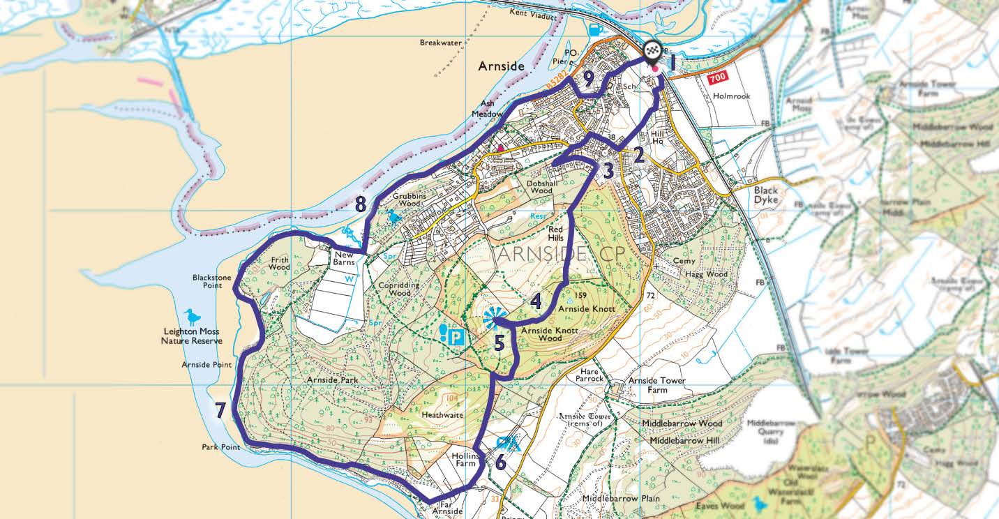
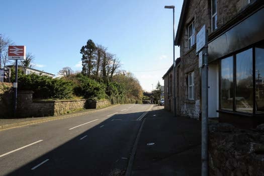
Step 1
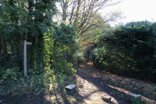
From Arnside train station, cross over Station Road and turn left, to have the railway on your left side. Just past the garage, the footpath rises from the road, and when it drops down, take the footpath on the right before the houses. The path turns sharp left and skirts between woods on either side. Eventually, the path comes out at a junction on Silverdale Road.
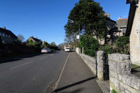
Step 2
Turn right here and walk along Silverdale Road, past the playing fields and shops on your right, and turn left down Red Hills Road. Follow the road around until you reach the first junction on the left, which is on a bend. This is High Knott Road; turn left and walk up the hill. Follow the road as it hairpin turns to the left.
Step 3
Soon, on the right, you’ll notice a footpath marked “The Knott” with a kissing gate into Red Hills Wood. Walk The Knott footpath through Dobshall Wood. As you emerge, there’s a junction of clear paths. Firstly, take the path up towards the stone kissing gate, go through and keep the woods to your left. Make your way up the hill then almost immediately take the path to the right, to walk to the top of Arnside Knott.
Step 4
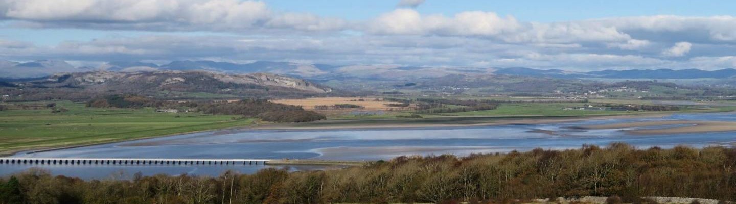
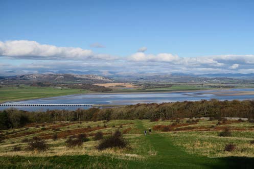
At the top, there’s some spectacular views all along the plateau of Arnside Knott. It might only be just shy of 500 feet high, but to the north, the south Lake District hills look stunning. Dropping down to the viewpoint (marked with a blue fan shape symbol on the map) gives a clearer view without the trees.
Step 5
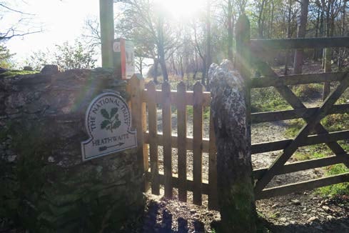
You are now roughly halfway through the Arnside Knott Walk! When you’re finished at the Arnside Knott viewpoint, take any of the paths to the south - so in the same direction as you walked up the hill - to get down. Head toward the caravan site below and eventually, you’ll find a footpath through Heathwaite which leads down to Hollins Farm – and that caravan site.
Step 6
At Hollins Farm, turn right along the footpath and bear right again to walk through the chalet park. The path now follows the line of the coast, with the craggy cliff on the left and the steep rise of Arnside Park on the right. Suddenly, the path drops down and you’re walking along the edge of the beach.
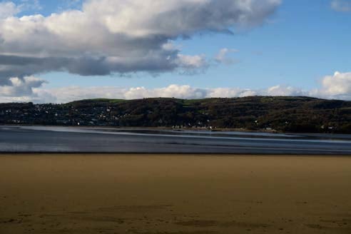
Step 7
Across the bay is Grange-Over-Sands, which seems so close you could walk to it, however, Morecambe Bay is a dangerous place to walk across. Continue along the coast path around the edge of Frith Wood and turn left at the junction of paths to keep on the coastal route.
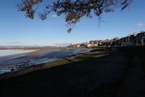
Step 8
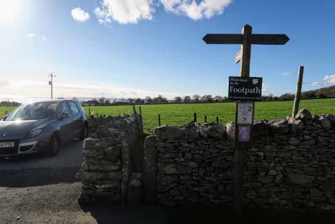
After Grubbins Wood, the path leaves the beach and joins The Promenade. Walk along The Promenade and turn right at the junction to walk up Silverdale Road. Before Silverdale Road bends sharply to the right, take Orchard Road on the left. Carry on until the road bends to the right, and there’s a footpath on the left, right on the corner. Take this path, with the stone wall on your left.
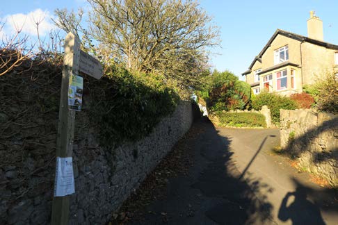
Step 9
The footpath comes out on Church Hill – with a church on your right. Cross over Church Hill and take the path slightly on your left between the two houses. This drops down to Station Road, where you need to turn right to get back to Arnside train Station. Congratulations, you’ve completed the Arnside Knott Walk.
We hope you enjoyed the Arnside Knott Walk and viewpoint! Looking for more walks or hikes in Northern England? See them here.
More to find in City and Country Walks
Northern App
Streamline your journey and get tickets straight to your phone. Making your journey contact-free.
Northern App
Streamline your journey and get tickets straight to your phone. Making your journey contact-free.